


Agriculture and Viticulture
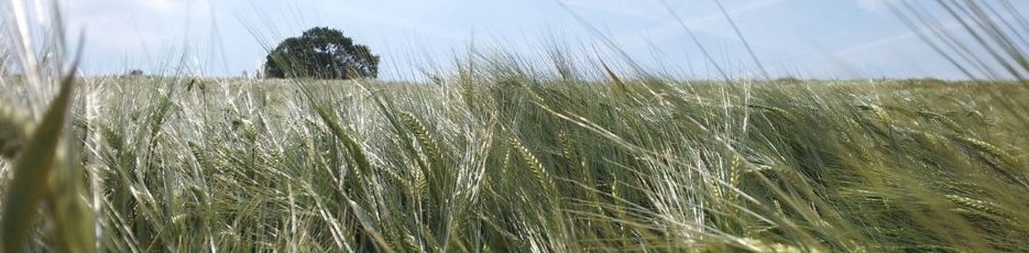
Various geophysical techniques benefit agriculture and viticulture, usually as part of a package examining soil health, irrigation and drainage, ultimately to increase crop yield or to reduce disease. Repeat survey, to quantify seasonal variation, may sometimes be required. Techniques can be deployed within a single field or vineyard or across the entire farm or region. Their greatest utility is often at the field-sized scale where small variations can impact significantly upon yield and vine health.
Soil structure
Among factors key to soil health are drainage and compaction, one influencing the other. Radar can be used to examine compaction, as below.
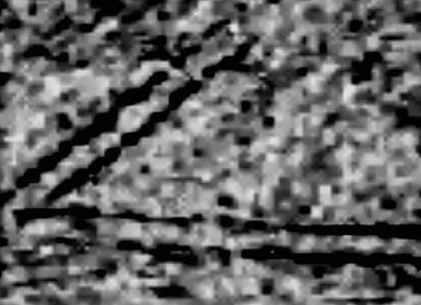
While subsoiling of tramlines is routine, knowing whether this has worked is difficult to ascertain on the whole-field scale. Electromagnetic techniques and radar can produce maps of variable compaction (and water holding) that can then be compared with soil and yield maps.
Drains and drainage
Drains are only any use if maintained and in the right places! Their function can easily be mapped using electrical and electromagnetic techniques, usually on a timelapse basis to exploit weather and seasonal variation.
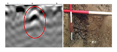
Various methods can be used to detect and map land drains, depending upon their construction and the soil around them. Electrical or electromagnetic techniques can work well although may require more than one visit. In dry clay-free soils a single visit with radar can be effective.
Why use TigerGeo?
We have a full suite of topographic and geophysical data collection, processing and specialist modelling tools at our disposal which allow us to examine the uppermost geological contexts and soils across landscapes and to assess the behaviour of water and nutrients within them.
Fast geophysical techniques mean that locating unmarked drains in large fields or mapping soil moisture variations can be a fairly trivial exercise. Construction of large topographic maps of land holdings is likewise straightforward for us.
Run-off and streamflow
Overland flow, e.g. over saturated or steep ground after rainfall or snowmelt, can increase soil loss and increased silt burden in streams.
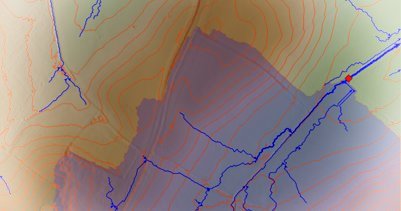
It can be modelled and the model used to site interceptor drains or dams depending upon whether water is to be diverted or captured. With soil data it also allows areas vulnerable to soil loss to be identified.
Soil moisture and irrigation
Electrical conductivity (ECa) and dielectric permittivity (from radar) can be exploited to yield maps of soil drainage classes and surface moisture retention. ECa value is proportional to the silt : sand ratio in clay-free soils and hence their ability retain water.
Topographic survey is normally used in conjunction with geophysical data when examining soil moisture so the effects of drying from sun and wind are better understood, as well as identifying areas where water becomes trapped.
One benefit of understanding soil moisture variation across a field or vineyard is being able to model how the soil responds to and retains warmth and therefore germination and root development. Another benefit, if timelapse survey is undertaken, is that models of nitrate uptake and nutrient loss can be made.
Techniques
Radar (GPR) surveys are best done after harvest, or, depending upon the crop, just before or just after drilling as it benefits from seed-bed like conditions. Electrical conductivity can be measured using either arrays of probes deployed after harvest or harrowing or by using electromagnetic induction (EMI) which is a non-contact technique avoiding contact with the crop. This can also be undertaken within some sorts of mature crop.
Within vineyards probe-based electrical and radar techniques are better suited than EMI survey as more immune to the metal of vine wires.


©TigerGeo Limited - Registered in England & Wales 09895326 - D-U-N-S 22-127-7456 - All Rights Reserved